Judgement, not just routing
The model evaluates the options in real time and recommends one, weighing cost and convenience alongside time.
AI travel assistant case study
Every mapping app in Bangladesh gives you a driving route. This one tells you which bus, whether to take a rickshaw at the end, and roughly what it should cost.
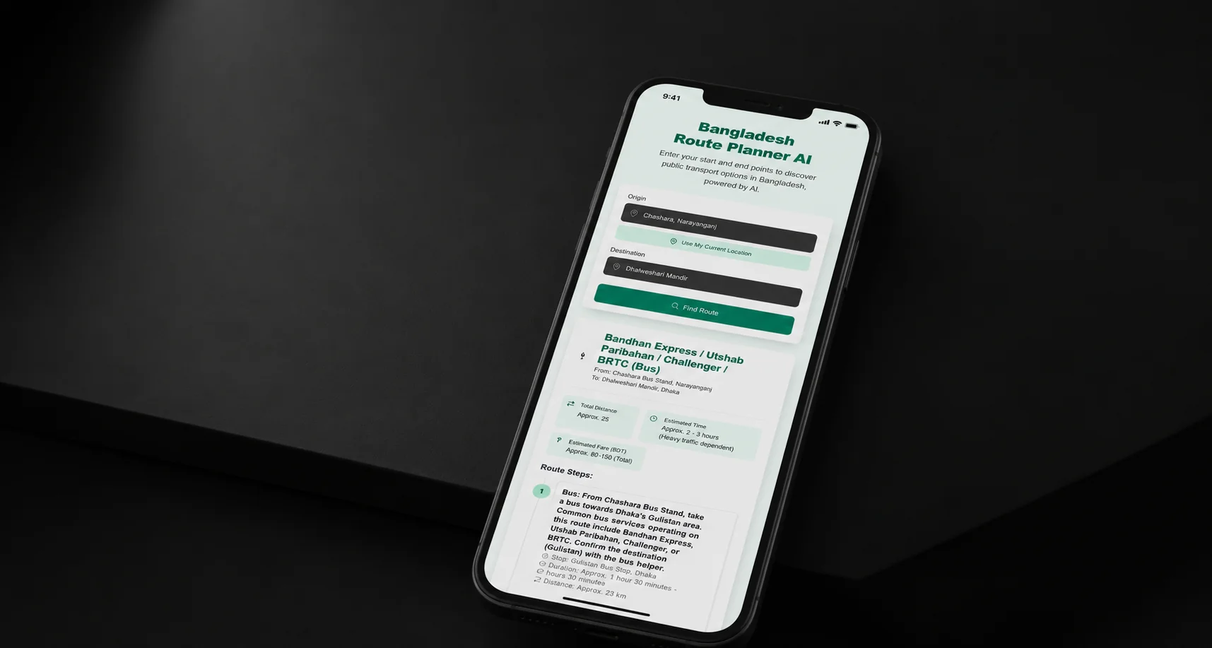
A journey planner built for how people actually move around Bangladesh. Give it where you are and where you are going, and it works out the sensible way to get there — not the theoretically shortest line on a map.
The recommendations name real local transport: which bus route, where a rickshaw makes more sense than waiting, when a CNG is worth the fare. Those are the modes that carry most journeys here and the ones a global routing engine has nothing to say about.
Gemini weighs the options against traffic, distance, cost and plain convenience; Google Maps supplies the geography, the live position and the timings underneath it.
Planning a real journey across the city, mode by mode.
It weighs the options, then picks
Traffic, distance, cost and convenience are considered together, and the answer is a recommendation rather than five routes to compare.
Local modes, by name
Buses with their route names and numbers, rickshaws, CNGs — the transport that actually carries the journey, named the way people name it.
Real geography underneath
Google Maps for mapping, live position and travel time, so the recommendation sits on top of accurate distances rather than guesses.
Tuned for one country
Built against how Bangladeshi roads and transport actually work, in cities and outside them, rather than adapted from somewhere else.
Ask a mapping app how to cross Dhaka and it will give you a driving time that assumes a car you may not have, or a transit route drawn from data that does not describe the buses actually running. The knowledge that gets somebody across the city — which route number, where to change, when the traffic makes a rickshaw faster than a car, what a CNG should cost for that distance — is local, informal, and held by people rather than by any transit feed. It is also exactly the knowledge a newcomer does not have.
The transit data does not exist
Informal networks are not published as timetables, so the routing engine has nothing to route with.
Traffic changes the right answer
The fastest mode at eight in the morning is not the fastest mode at two in the afternoon, and distance alone will not tell you which.
Cost matters as much as time
For most journeys the decision is fare against minutes, and a planner that only optimises minutes is answering a different question.
The split is deliberate. Google Maps does what it is good at — geography, positions, distances and live travel time — and Gemini does the part that needs judgement: given this distance, this traffic and these modes, what would somebody who knows this city actually do? The output is a plan in transport people recognise, with the reasoning in it, rather than a polyline and an estimate.
The model evaluates the options in real time and recommends one, weighing cost and convenience alongside time.
Geolocation, mapping and estimated travel time come from Google Maps, so nothing about the geography is invented.
Mode by mode, in local terms — which bus, where to switch, where to walk — instead of a single line to interpret.
Solution: Informal transport has no feed to query, so the planner cannot look the answer up. Gemini is given the geography from Maps and asked for the judgement instead — which is the right shape for a problem where local practice, not published data, holds the answer.
Solution: A language model asked about routes will produce confident, plausible geography. Distances, positions and travel times come from the Maps API and are handed to the model as facts, so its contribution is the recommendation rather than the map.
Solution: Cheapest and fastest are frequently different routes, and picking one silently is a decision made on the traveller's behalf. Cost and convenience are weighed explicitly so the recommendation can say which trade-off it made.
Let's build the one that does.